
Two Week Glance (1/30)
Week 1: January 30th - February 5th
Week 2: February 6th - February 12th
A relatively docile weather pattern gets us through Week 1 with relatively stable, seasonally appropriate temperatures. After a dry start to the week, a storm system brings what looks like a shot at some accumulating snow to the Midwest on Saturday/Sunday (Feb 4/5) at the end of Week 1. A second, quick-moving system which may bring one more coating of snow to the region around Tuesday/Wednesday (Feb 7/8) rounds out an otherwise dry Week 2.
Overview:
Temperature Trends:
Week 1: Average
Week 2: Below Average
High temperatures during the Week 1 period will generally be right at climatological averages, generally holding steady in the 30s. Low temperatures will range from the 20s early in the week, to the teens near the end of Week 1.
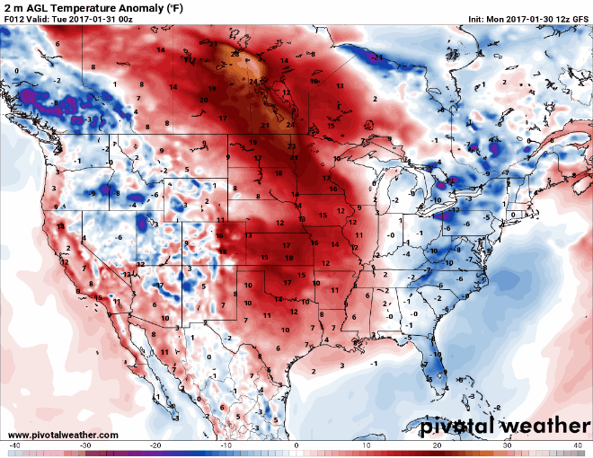
In Week 2, a cold start to the week following potentially accumulating snows in the region keeps temperatures about 5 to 10 degrees below average. High temperatures during Week 2 are expected to be in the middle to upper 20s, until a potential warm-up at the end of Week 2. Low temperatures during Week 2 will generally be in the teens, and lower 20s.
Temperature anomaly loop through Weeks 1 & 2 shows fairly stable, average temperatures before a drop to below average (blue shading) for much of Week 2. The end of the loop does hint at a warming trend toward the end of Week 2:
Precipitation Trends:
Week 1: Average
Week 2: Below Average
A couple of quick moving clipper-like systems will bring periodic chances for very light snow flurries during Week 1 before a potentially more significant storm system impacts the Midwest over the weekend, (February 4th/5th) at the end of Week 1. Current long-range estimates on total accumulation from this storm system are unclear, but several inches of accumulating snow does seem reasonable at this point. Plenty of variables will go into that shifting/changing up or down over the coming week.
Looking beyond this weekend, the Week 2 forecast period looks relatively quiet. There are hints at a quick moving reinforcing shot of light snow moving into the region in the Tuesday/Wednesday (Feb 7th/8th) time frame. Otherwise, a quiet and dry pattern rules.
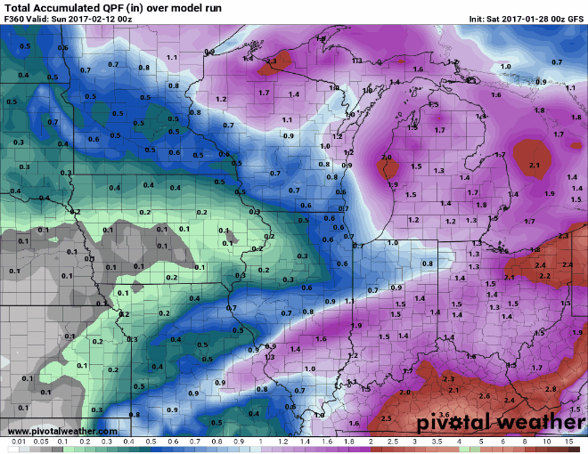
Total precipitation during the combined Week 1 & 2 period ending February 12th will likely end up between 0.3" and 0.8".
Looping through model trends for total precipitation through Weeks 1 & 2 shows the heaviest precipitation totals remaining off to our north and south, with us likely finishing the period very near 0.5" total. Most of this will come in the form of snow, with several inches of accumulation possible during the period.